Agriculture


Crop production:
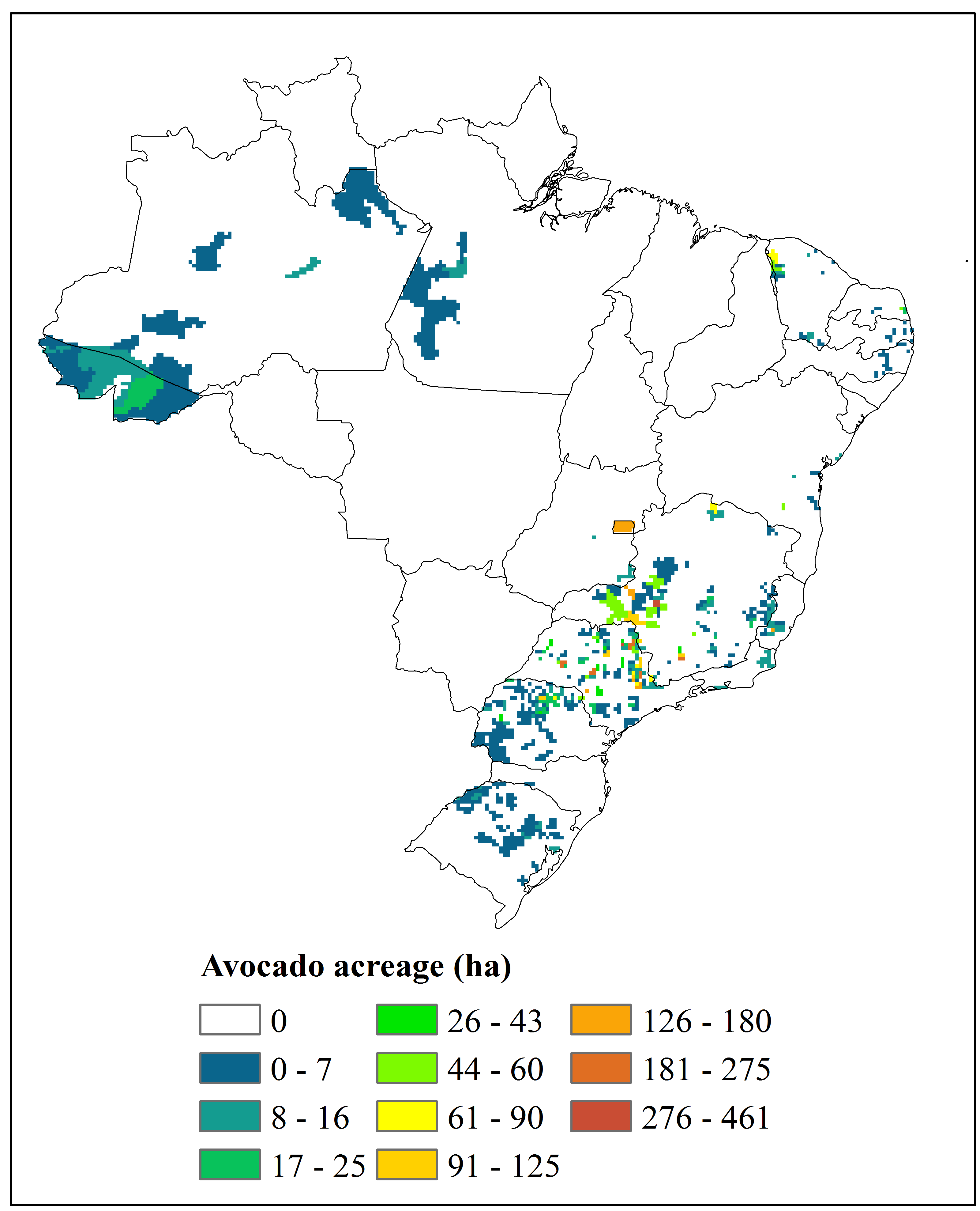
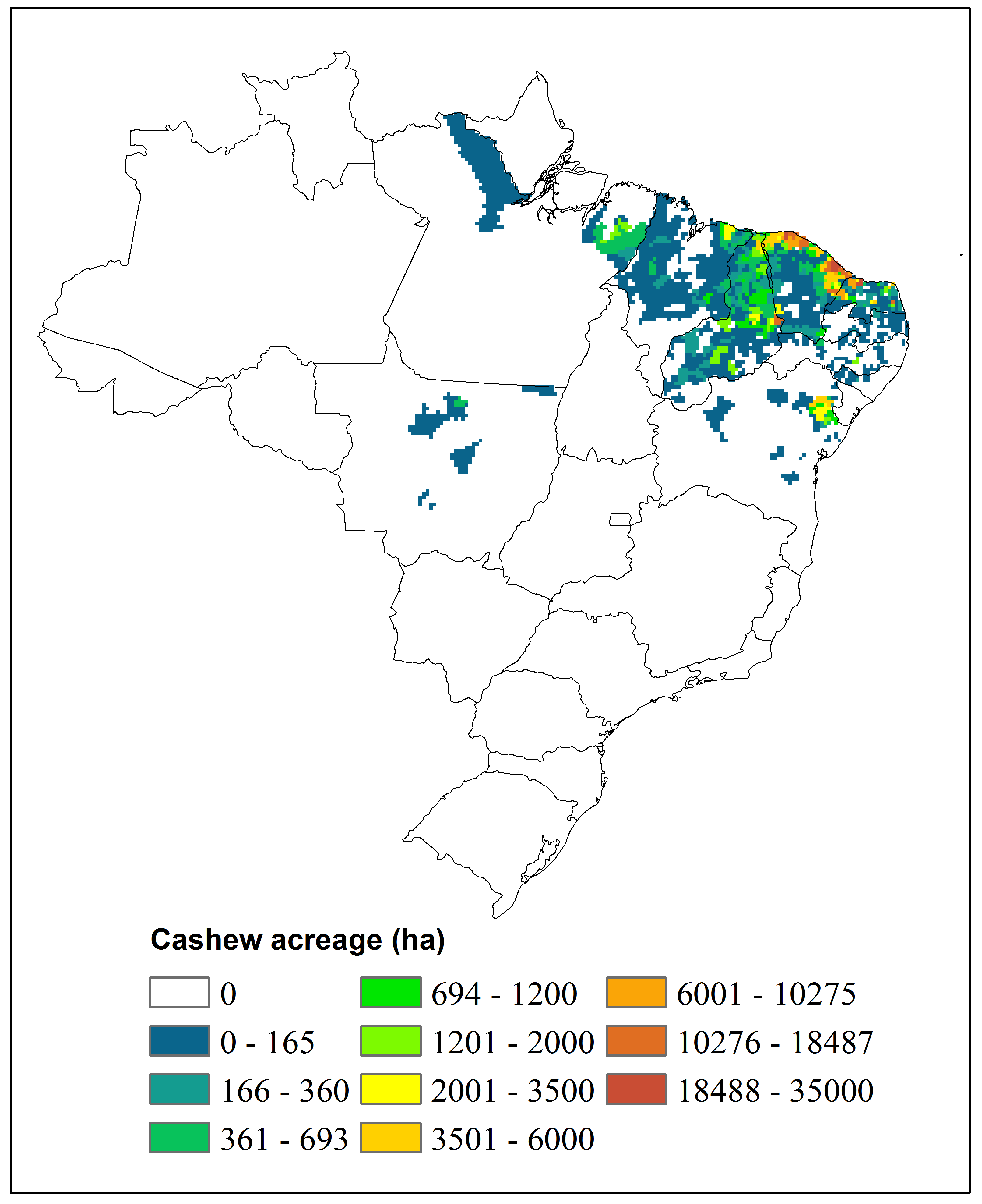
The Brazilian Institute of Statistics and Geography (IBGE) provides update and freely available data on the Brazilian crop production. These data include crop yield, planted and harvested area, among others. NEMI provides maps of crop acreage for each Brazilian municipality based on the data provided by IBGE from 2014 (png format). The maps can be obtained in shape format (.shp) for use in teaching and research projects. In this case, please contact us via e-mail requesting the files you need.
-
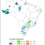
- Abacate/Avocado
-
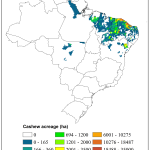
- Caju/Cashew
-
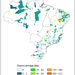
- Goiaba/Guava
-
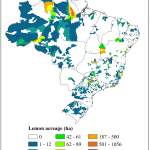
- Limão/Lemon
-
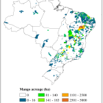
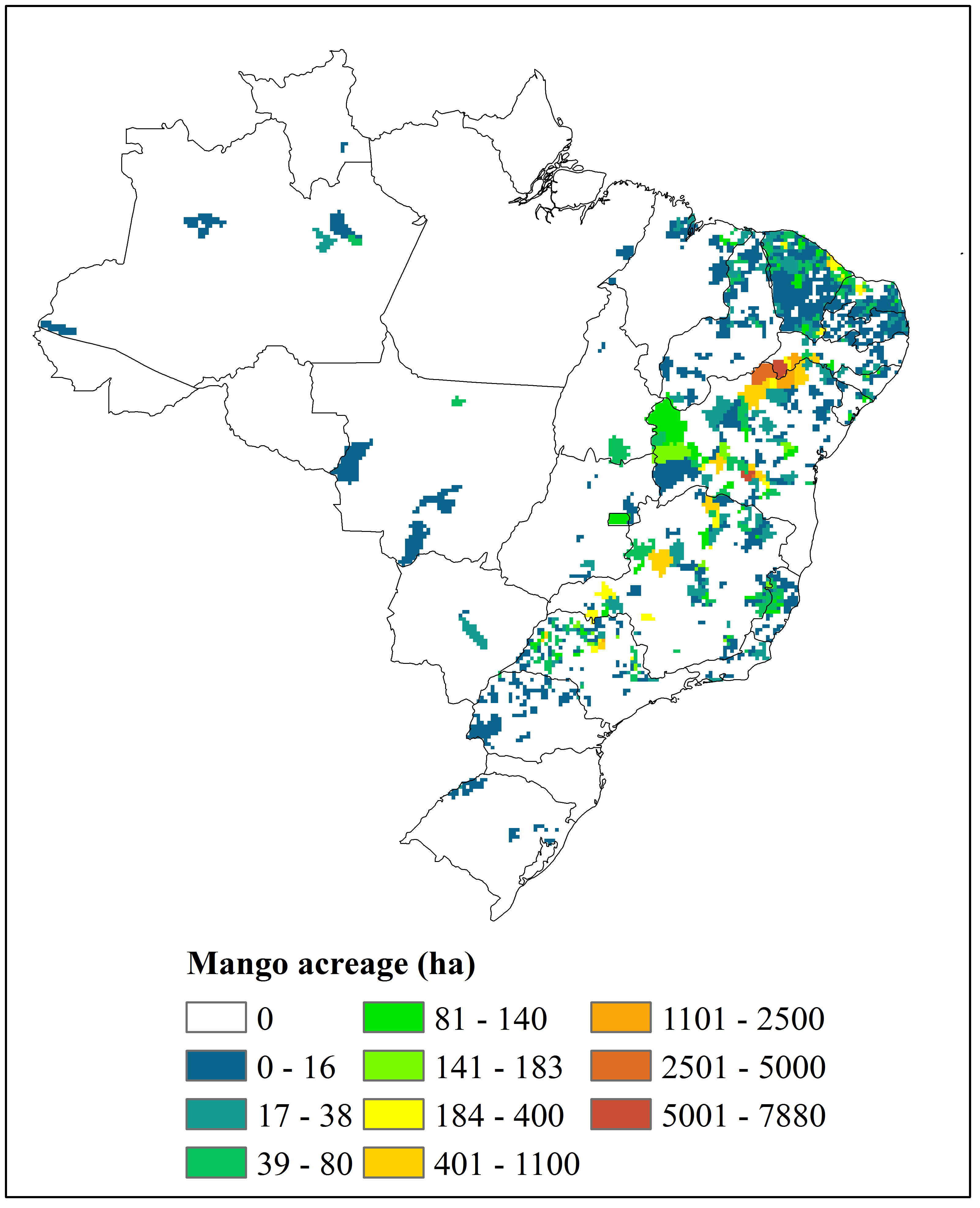
- Manga/Mango
-
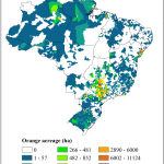
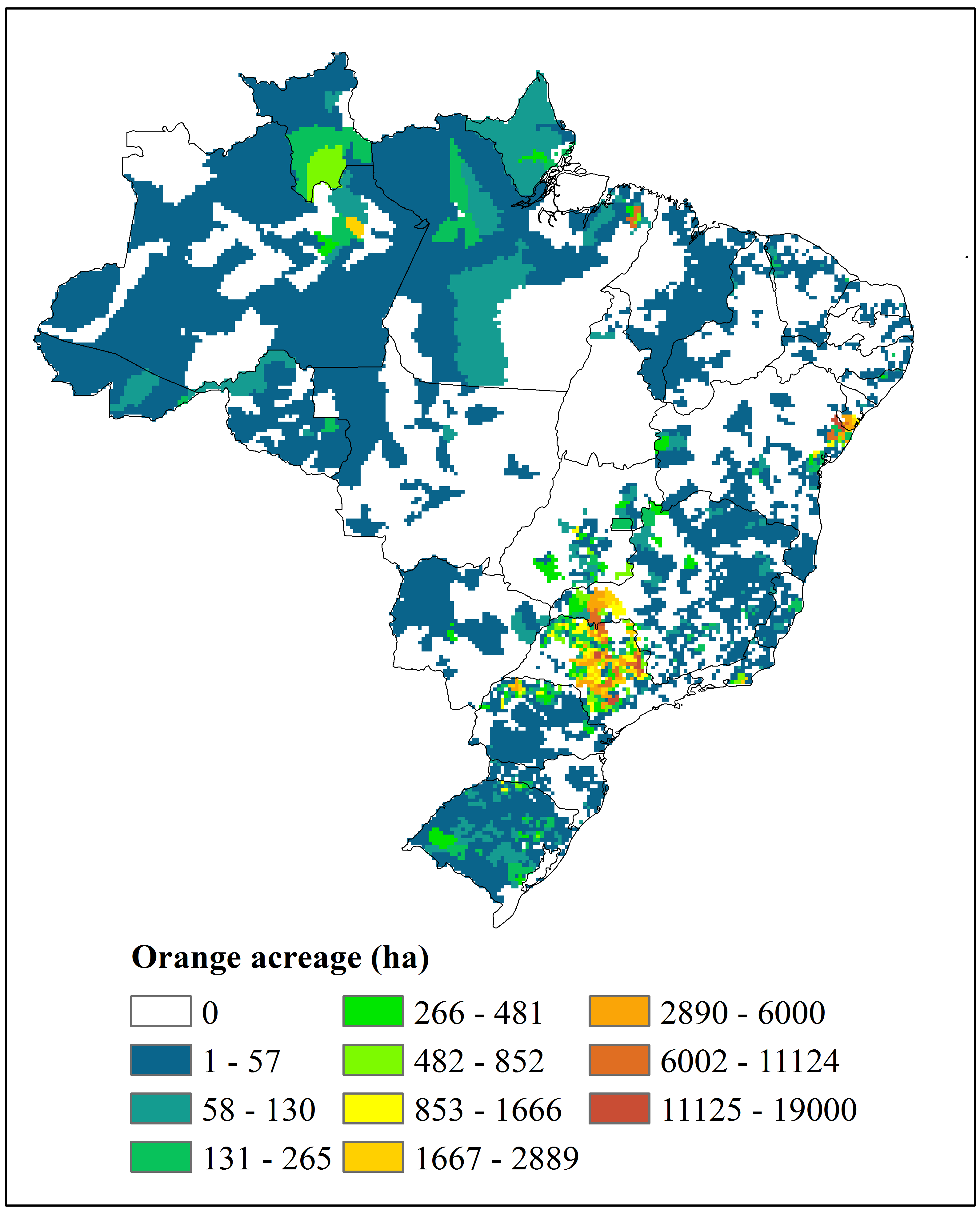
- Laranja/Orange
-
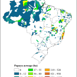
- Mamão/Papaya
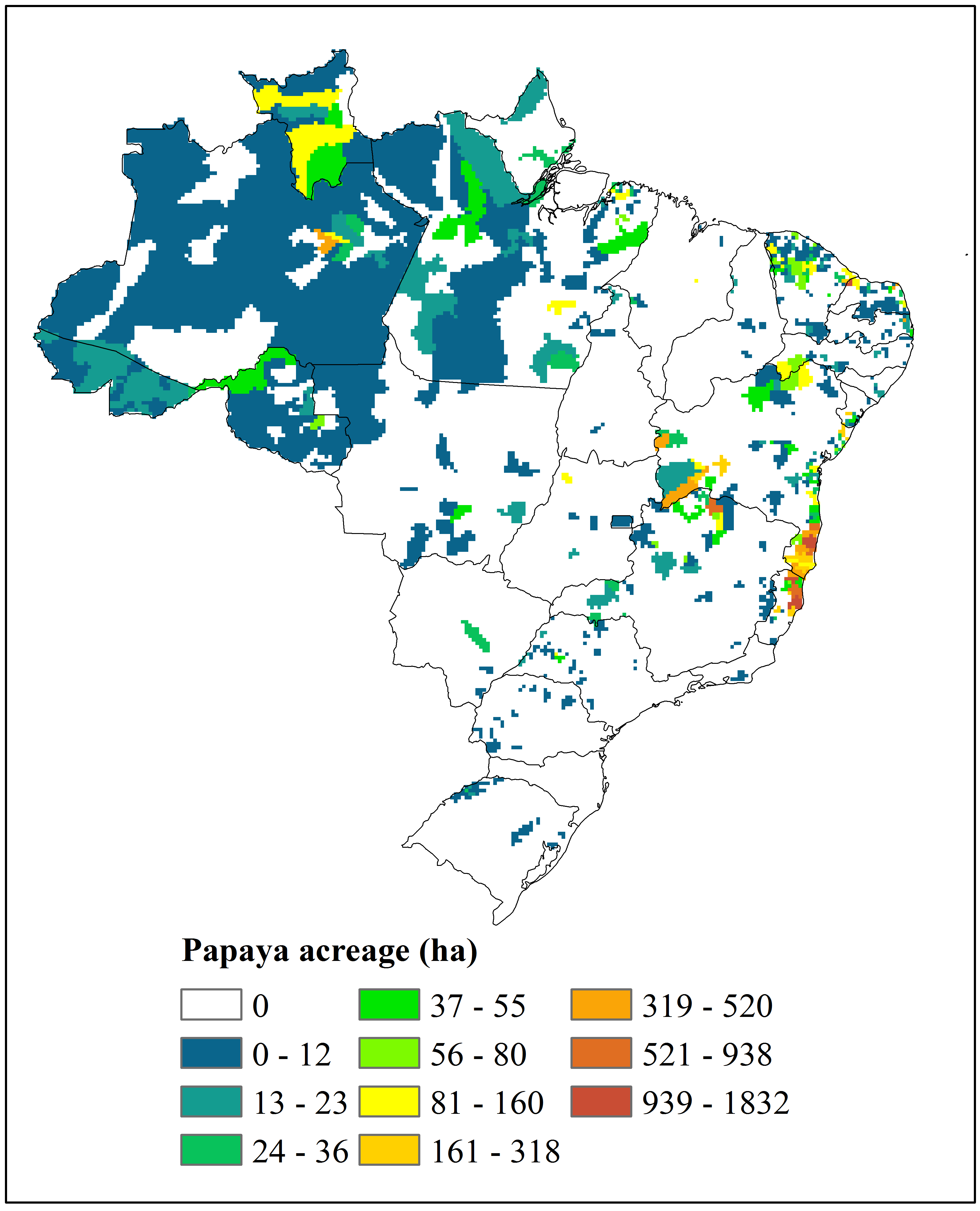
-
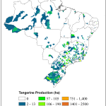
- Tangerina/Tangerine
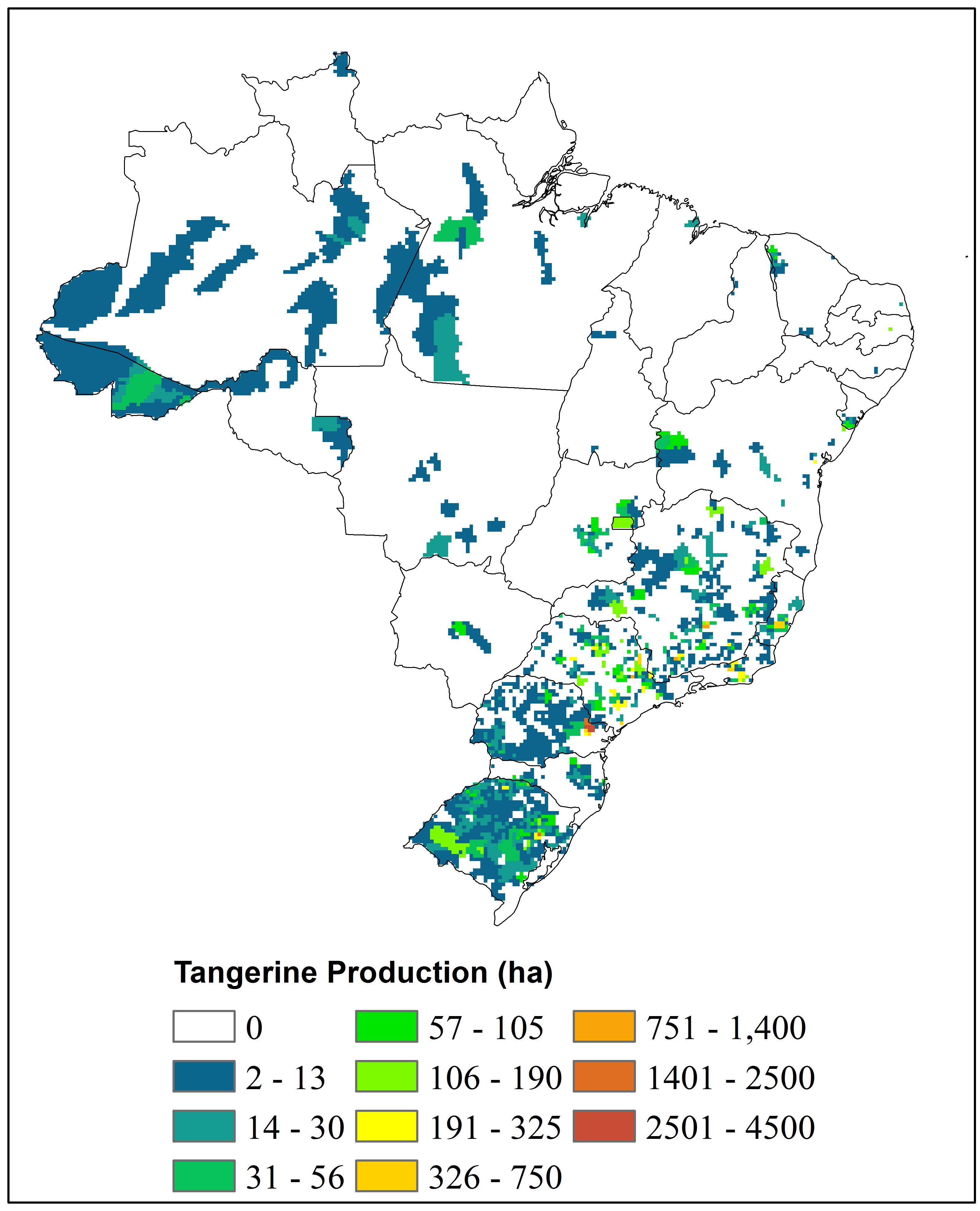
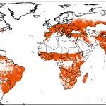
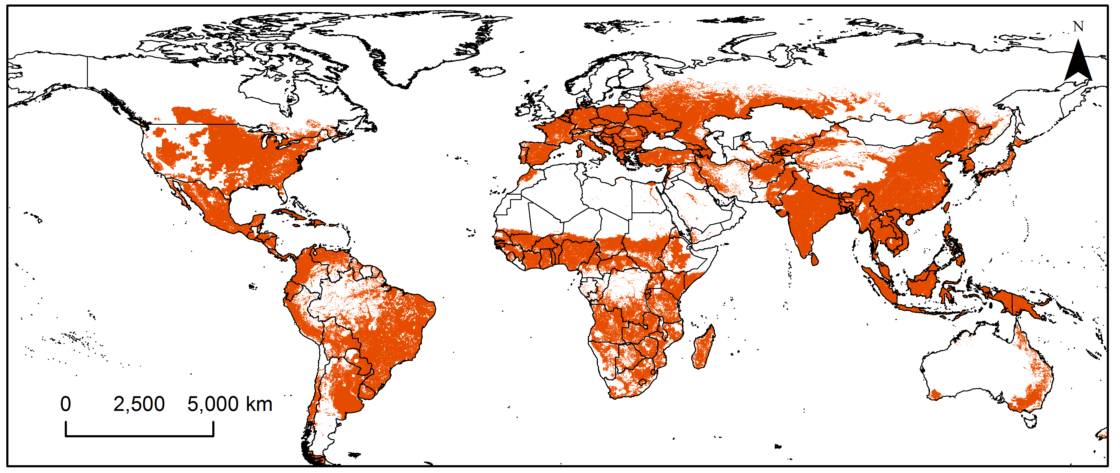
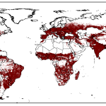
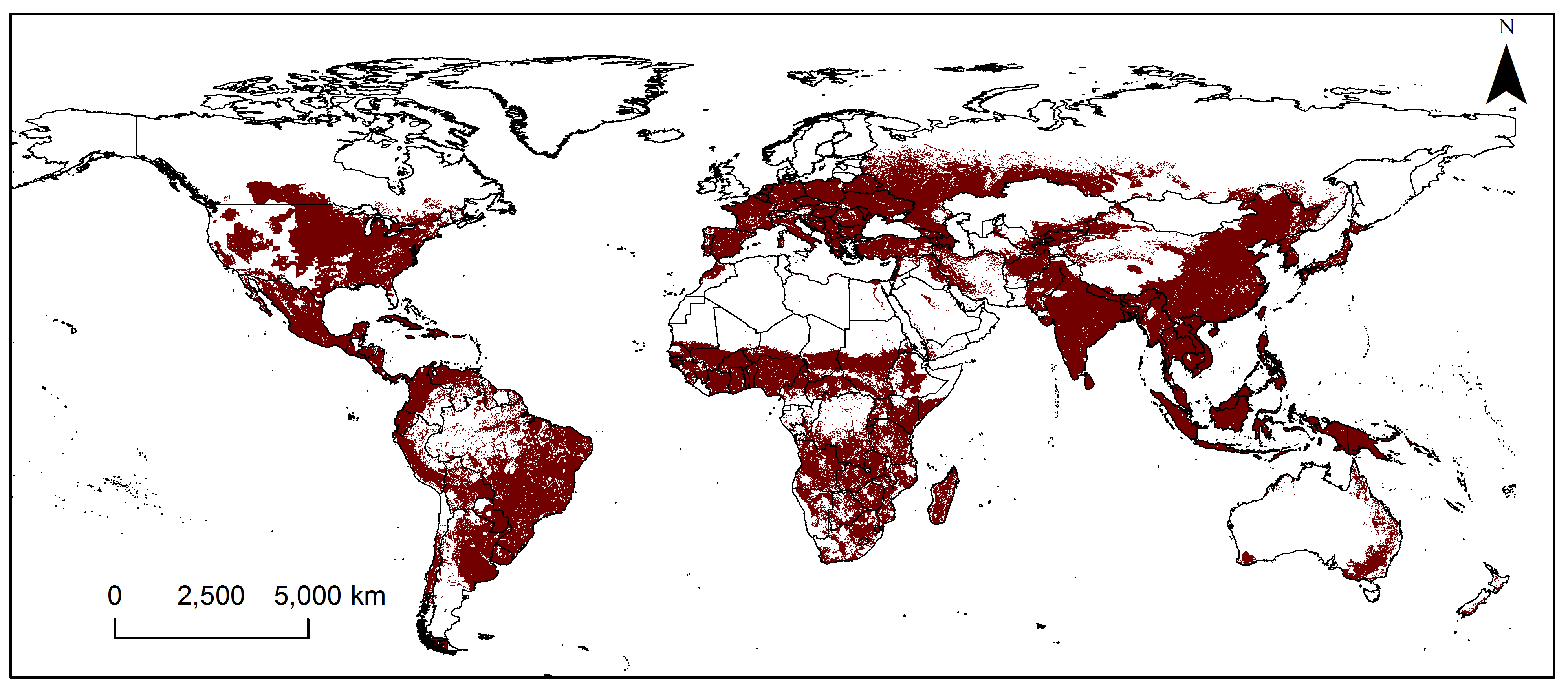
Citação: Marchioro CA (2016) Global Potential Distribution of Bactrocera carambolae and the Risks for Fruit Production in Brazil. PLoS ONE 11(11): e0166142. doi:10.1371/journal.pone.0166142
Also, data on the maize and soybean acreage in Brazil during the last ten years are freely available. Please contact us if you need the shapefile.
 |
 |
| Maize | Soybean |
EarthStat provides geographic data related to crop production, including data on yield, planted area and greenhouse gas emission. This project is a collaboration between the University of Minnesota’s Institute on the Environment and the University of British Columbia, Vancouver.
Global maps showing the regions where maize and soybean are cultivated were built by NEMI based on the study carried out by Monfreda et al. (2008). Data are freely available in .png format, but it can be obtained in shape format (.shp) for teaching and research purposes. Please contact us to obtain the files in shape format.
-
- Soja/Soybean
-
- Milho/Maize
Citation: Marchioro, C.A. (2016) Soybean acreage. In http://nemi.ufsc.br/agricultura/soyabean_map/. Marchioro, C.A. (2016) Maize acreage. In http://nemi.ufsc.br/agricultura/soyabean_map/.